Start Date
27-10-2017 11:00 AM
End Date
27-10-2017 11:30 AM
Abstract
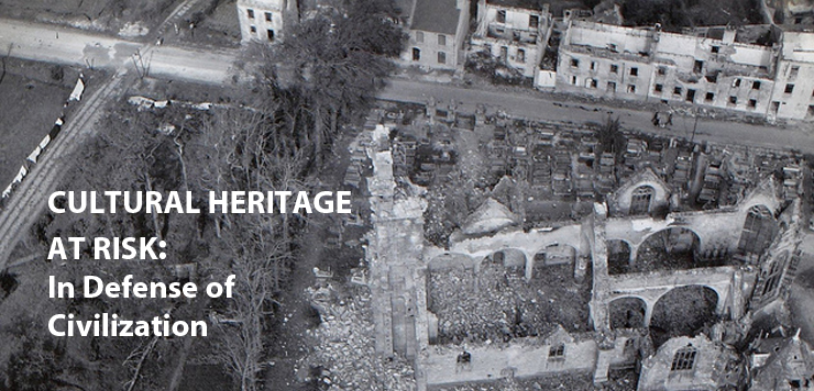
Hurricane Katrina devastated the Gulf Coast in August 2005 and created the single largest disaster for cultural resources that the United States has witnessed since the inception of the National Historic Preservation Act (NHPA) in 1966. Notably, the NHPA created the National Register of Historic Places, our nation’s catalog of important cultural resources. The NHPA also stipulates that any federal undertaking which may adversely affect National Register eligible resources be mitigated. For the Federal Emergency Management Agency (FEMA), Katrina created the largest compliance project ever under Section 106 of the NHPA.
Although causing a great deal of damage, Katrina also provided an important learning tool in developing processes, identifying challenges and generating solution sin responding to extensive cultural resources issues in a disaster. Involving spatial technologies such as geographic information systems (GIS) and global positioning systems (GPS) in strategies for a large-scale compliance with historic preservation laws proved invaluable in identifying potential cultural resources, in evaluating those resources for their eligibility to the National Register, and in providing important treatment measures during long term recovery efforts. Creating these digital cultural resource inventories, as well as developing data standards and processes to share that data quickly following a disaster are all critical elements of protecting our heritage and in improving preparedness for future emergencies.
Ten years after Katrina, integrating spatial technologies in disaster response has become a necessity, based on the strategies undertaken in Louisiana, but now with better, faster, more comprehensive data and capabilities available. These new tools and techniques improve the efficiency of response and better prepare communities for coming disasters. Our capacity to document, integrate, visualize and share our cultural heritage with GIS will ultimately lead to enhanced protection for cultural resources in the long term, as well as the development of new spatial technologies.
Included in
Archaeological Anthropology Commons, Architectural History and Criticism Commons, Art and Materials Conservation Commons, Arts Management Commons, Atmospheric Sciences Commons, Cultural Resource Management and Policy Analysis Commons, Environmental Indicators and Impact Assessment Commons, Environmental Monitoring Commons, Fine Arts Commons, Forensic Science and Technology Commons, Geographic Information Sciences Commons, Historic Preservation and Conservation Commons, International Relations Commons, Meteorology Commons, Other History of Art, Architecture, and Archaeology Commons
Informing Responders Using GIS and GPS
Hurricane Katrina devastated the Gulf Coast in August 2005 and created the single largest disaster for cultural resources that the United States has witnessed since the inception of the National Historic Preservation Act (NHPA) in 1966. Notably, the NHPA created the National Register of Historic Places, our nation’s catalog of important cultural resources. The NHPA also stipulates that any federal undertaking which may adversely affect National Register eligible resources be mitigated. For the Federal Emergency Management Agency (FEMA), Katrina created the largest compliance project ever under Section 106 of the NHPA.
Although causing a great deal of damage, Katrina also provided an important learning tool in developing processes, identifying challenges and generating solution sin responding to extensive cultural resources issues in a disaster. Involving spatial technologies such as geographic information systems (GIS) and global positioning systems (GPS) in strategies for a large-scale compliance with historic preservation laws proved invaluable in identifying potential cultural resources, in evaluating those resources for their eligibility to the National Register, and in providing important treatment measures during long term recovery efforts. Creating these digital cultural resource inventories, as well as developing data standards and processes to share that data quickly following a disaster are all critical elements of protecting our heritage and in improving preparedness for future emergencies.
Ten years after Katrina, integrating spatial technologies in disaster response has become a necessity, based on the strategies undertaken in Louisiana, but now with better, faster, more comprehensive data and capabilities available. These new tools and techniques improve the efficiency of response and better prepare communities for coming disasters. Our capacity to document, integrate, visualize and share our cultural heritage with GIS will ultimately lead to enhanced protection for cultural resources in the long term, as well as the development of new spatial technologies.
Speaker Information
Deidre McCarthy holds a B.A. from Mary Washington College in Historic Preservation and an M.A from the University of Delaware in Urban Affairs and Public Policy, with a specialization in Historic Preservation. She is Chief of the Cultural Resources GIS Facility (CRGIS) of the National Park Service (NPS), in Washington, D.C., the only office within the NPS dedicated to applying GIS to cultural resource management and planning. There, she focuses primarily on helping State/Tribal Historic Preservation Offices and National Park units to integrate both GIS and GPS into their traditional preservation activities. At CRGIS for the past twenty years, she has helped preservationists identify applications for these technologies in daily activities through a variety of projects across the country and within National Park units, as well as providing GIS/GPS training and other guidance. As part of these efforts, she led a team to create NPS cultural resource spatial data transfer standards to help facilitate data exchange, enhancing cultural resource management and serving as a foundation for an NPS cultural resource enterprise data set. These standards and this data set will allow the NPS to respond to natural and man-made disasters more quickly and efficiently. Currently, she is working to develop similar Federal standards for cultural resource spatial data.